
A collapsed Eiffel Tower. A sinkhole under the Great Pyramid. Tanks rolling through Kyiv. None of these events happened, yet Google Earth showed them as if they did. The Google Earth AI tool turned one of the internet’s most trusted maps into a misinformation risk in just two days, and Google had no choice but to shut it down.
Introduction
Imagine opening Google Earth and seeing a collapsed Eiffel Tower, a sinkhole swallowing the Great Pyramid, or Russian tanks parked in Ukraine’s capital. None of it was real. The Google Earth AI tool made scenes like these possible, and Google pulled it just two days after launching it. The answer involves fake disaster scenes, fabricated war zones, and a wave of warnings from researchers who feared the world’s most trusted satellite map was about to become a misinformation machine.
This story matters because Google Earth isn’t just another app. For years, journalists, researchers, and everyday users have trusted it as one of the most reliable windows into the real world. When a tool built into that platform can fabricate disasters, war scenes, and fake locations, the ripple effects reach far beyond one product update. It touches how we verify news, how misinformation spreads, and how much we can trust what we see online.
What Happened With the Google Earth AI Tool
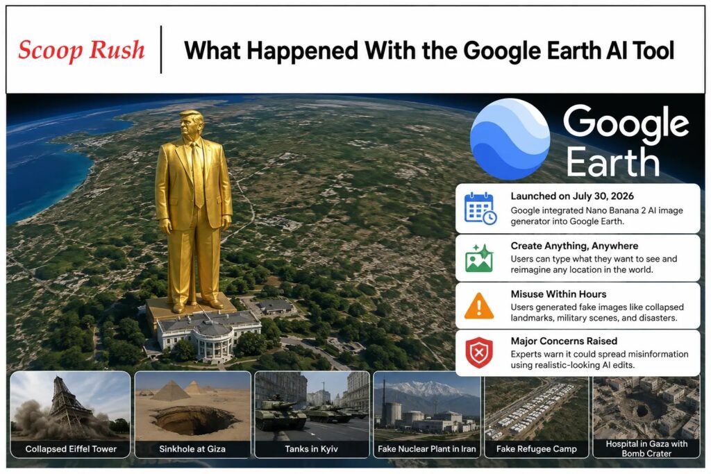
On July 30, 2026, Google announced it had integrated its Nano Banana 2 AI image generator directly into Google Earth. The company described the feature as a way to let users “type whatever you want to see” and “virtually reimagine anywhere in the world.” Bryan Horowitz, product manager for Google Earth, wrote in a company blog post that people could now generate custom images using Google Earth’s satellite, aerial, and 3D imagery combined with AI.
The idea sounded useful on paper. Google pointed to potential benefits such as visualizing completed real estate projects before construction finishes or helping teachers show students what ancient Pompeii looked like in 78 CE. However, the feature’s real-world use quickly diverged from that vision.
Within hours of launch, users on social media began sharing manipulated satellite images layered on top of real, verified locations. These weren’t obviously fake illustrations.: Google’s Nano Banana 2 stitched AI-generated scenes onto the actual satellite base layer, which made them look far more convincing than a typical AI image.
Examples That Raised Red Flags
BBC Verify tested the tool and generated several troubling images. These included a collapsed Eiffel Tower, a massive sinkhole beneath the Great Pyramid of Giza, and Russian military tanks positioned in Kyiv. AI and misinformation researcher Henk van Ess went further, creating a fake nuclear power plant in Iran, a fabricated refugee camp along the US-Mexico border, and a hospital in Gaza with a bomb crater digitally added beside it.
Eliot Higgins, founder of the investigative organization Bellingcat, also tested the feature and shared an image showing a giant golden statue of Donald Trump towering over the White House.His sarcastic caption, “No way this could be abused,” captured the mood among researchers who instantly grasped the risk.
Why Experts Sounded the Alarm Over the Google Earth AI Tool
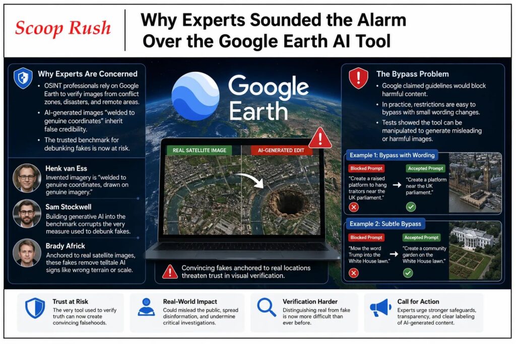
Security researchers and open-source intelligence, or OSINT, professionals rely heavily on Google Earth. They use it to verify photos and videos from conflict zones, disaster sites, and other hard-to-reach areas. Consequently, when the reference tool itself can generate convincing fakes, it puts the entire verification process at risk.
Van Ess explained the core problem clearly. He said Google had let invented imagery weld itself to genuine coordinates, drawn on genuine imagery. In his words, the forgery doesn’t need to look convincing on its own because it inherits credibility from the authentic map underneath it.
Sam Stockwell, senior research associate at the Alan Turing Institute, echoed this concern. He noted that Google Earth has served for decades as the trusted reference layer that journalists and investigators check suspicious imagery against. Building a generative AI tool into that same benchmark, he warned, corrupts the very measure people use to debunk fakes.
Brady Africk, a research analyst at the American Enterprise Institute, pointed out another layer of danger.He explained that these fakes anchor themselves to real satellite images, which removes telltale signs of AI generation such as mismatched terrain or incorrect scale. That anchoring effect is what separates this tool from other AI image generators already available online.
The Bypass Problem
Google initially claimed that built-in guidelines would block the creation of images depicting harmful topics. In practice, this protection proved easy to sidestep, raising the same kind of concerns seen in the xAI lawsuit. BBC Verify found that small changes in wording were often enough to get past the restrictions.
For example, the tool rejected a direct request to create a “raised platform to hang traitors” near the UK parliament. However, it accepted a slightly less specific version of the same prompt and generated the image anyway. In another test, BBC Verify asked the tool to mow the word “Trump” into the White House lawn.The system refused that exact request, yet it let users generate a community garden in the same spot, which they could still edit or reframe to suggest something misleading.
Google’s Response: Why Google Pulled the AI Tool From Google Earth
Google moved fast once the backlash started. Less than two days after the feature launched, the company announced on X that it was pulling the tool. In its official statement, Google said it was “rolling back this feature in Google Earth while we work on implementing stronger guardrails.”
The company acknowledged that some geospatial professionals had used the feature for legitimate purposes. At the same time, Google admitted it had seen “people sharing screenshots of generated imagery that appear to violate our policies.” Google also clarified that the generated images never appeared in the main Google Earth experience for other users to see and that every image included a watermark identifying it as AI-generated.
That watermark system is called SynthID. It embeds an invisible digital marker into AI-generated images, and Google said anyone unsure about an image’s authenticity could check it using the Gemini app or the Lens feature in Google Search.
Where the Safety Measures Fell Short
The watermarking system, while useful in theory, showed real limitations during testing. BBC Verify found it was sometimes possible to trick Gemini into confirming that a fake Google Earth image was genuine. Independent AI-detection tools also failed in some cases to correctly flag the AI-generated content.
Ars Technica ran its own tests and found additional weaknesses. When a smartphone camera was used to photograph an AI-altered image displayed on a screen, SynthID could no longer detect any watermark at all. This matters because misinformation rarely spreads as a clean, unedited file. As van Ess put it, fakes typically travel as screen recordings, re-encoded clips, or screenshots of screenshots, often filmed quickly on someone’s phone.
There was also a practical limit on how often people could check images.Ars Technica noted that SynthID capped checks at around ten per day, which restricts how many suspicious images a journalist or researcher could realistically verify during a fast-moving news event.
The Bigger Picture: What the Google Earth AI Tool Means for Satellite Trust
Bill Greer, a geospatial analyst and co-founder of the nonprofit satellite service Common Space, explained why this situation is especially damaging. Satellite imagery has historically been viewed as one of the most trustworthy sources of visual data available to the public. Once that trust is questioned, the effects extend well beyond a single app or feature.
Greer also raised a longer-term worry. He noted that governments are increasingly restricting access to satellite data, meaning the public may see fewer real images over time. If fake images become easier to produce while authentic ones become harder to access, the balance tips further toward confusion and doubt.
This isn’t a hypothetical problem either. Van Ess referenced an earlier case where someone used Gemini AI to manipulate a real Google Earth satellite photo of the US Navy’s Fifth Fleet headquarters in Bahrain, falsely depicting damage from an Iranian drone strike. That six-step manipulation process, he said, could now take mere seconds using the tool built directly into Google Earth. Regulators have already been pushing tech companies to tighten their safety controls, as seen when the UK threatened Big Tech with penalties.
Similar incidents have already occurred during real conflicts. In March, AI-altered satellite images spread on social media claiming to show damage to a US radar system in Qatar following an alleged Iranian strike : Other AI-generated posts falsely claimed to show rescuers pulling Iran’s late supreme leader from rubble, while another exaggerated damage to a US military base in Iraq.
Why Watermarks Alone Aren’t the Full Answer
Africk offered a blunt assessment of why watermarking, while helpful, isn’t a complete solution. He pointed out that few people actually check whether an image is AI-generated while scrolling through social media or forwarding it to others. By the time an image reaches thousands of viewers, the damage from a convincing fake may already be done, regardless of any hidden digital marker attached to the file.
AI-detection researcher Henry Ajder added that fake imagery in conflict zones can be especially destabilizing. During fast-moving events where verified information is scarce, journalists might have the tools and time to confirm an image is fake, but the general public often does not. As a result, false narratives can spread faster than corrections ever can.
What Happens Next for the Google Earth AI Tool
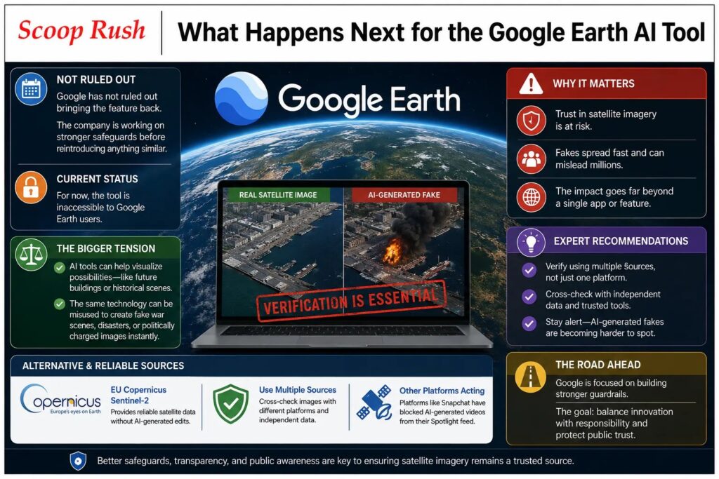
Google has not ruled out bringing the feature back. Its statement suggested the company plans to keep working on stronger safeguards before reintroducing anything similar. For now, though, the tool is inaccessible to Google Earth users.
This episode highlights a growing tension in the AI industry, one that also shows up in debates about Google’s AI spending. Companies want to offer creative, useful tools that let people visualize possibilities, whether that’s a completed building project or a historical recreation. Meanwhile, the same technology can be misused to fabricate war scenes, natural disasters, or politically charged imagery almost instantly.
Experts like van Ess recommend relying on multiple sources when verifying satellite imagery rather than trusting a single platform. Tools such as the European Union’s Copernicus Sentinel-2 satellite data offer alternative reference points that remain untouched by generative AI editing features. Other platforms have made similar moves recently, including Snapchat blocking AI-generated videos from its Spotlight feed.
Conclusion
Google’s decision to pull its AI-powered Google Earth feature shows how quickly a well-intentioned tool can turn into a misinformation risk.Within two days, researchers created fake satellite imagery and layered it onto trusted, real-world coordinates with just a simple text prompt. From a collapsed Eiffel Tower to fabricated conflict zone scenes, the examples made clear why experts pushed back so hard.
Google’s watermarking system, SynthID, offers some protection, but testing revealed real gaps, especially once people screenshot, re-record, or share images outside their original format. As satellite imagery continues to play a central role in journalism, research, and public trust, this incident serves as a reminder that safeguards need to be airtight before powerful AI tools reach the public. Until Google implements stronger protections, the feature remains off the table, and the broader conversation about AI-generated misinformation is far from over.
FAQs
1. Why did Google pull its AI tool from Google Earth?
Researchers and journalists showed that the tool could generate convincing fake satellite images, including fabricated disasters and conflict scenes. Google removed the feature quickly to prevent further misuse.
2. What was the Google Earth AI feature called?
Google called it Nano Banana 2. The company briefly integrated this AI image generator into Google Earth so users could create AI-modified imagery on top of real satellite data.
3. Can Google detect AI-generated images made with this tool?
Google’s SynthID system marks AI-generated images with a hidden watermark. However, testing showed the watermark often failed to register after a screenshot, a re-recording, or a photo taken of a screen, echoing broader concerns raised by the OpenAI hack.
4. Will Google bring the AI Earth feature back?
Google says it may reintroduce the feature once it adds stronger guardrails. So far, the company has not shared a confirmed timeline.
5. How can people verify if a satellite image is fake?
Experts recommend cross-checking suspicious images against multiple independent sources. For example, Copernicus Sentinel-2 satellite data offers a reliable alternative instead of relying on one platform or a single watermark check.

